
An online auction featuring furniture, silverware, a wide selection of posters, and various pottery items
Lot 89:
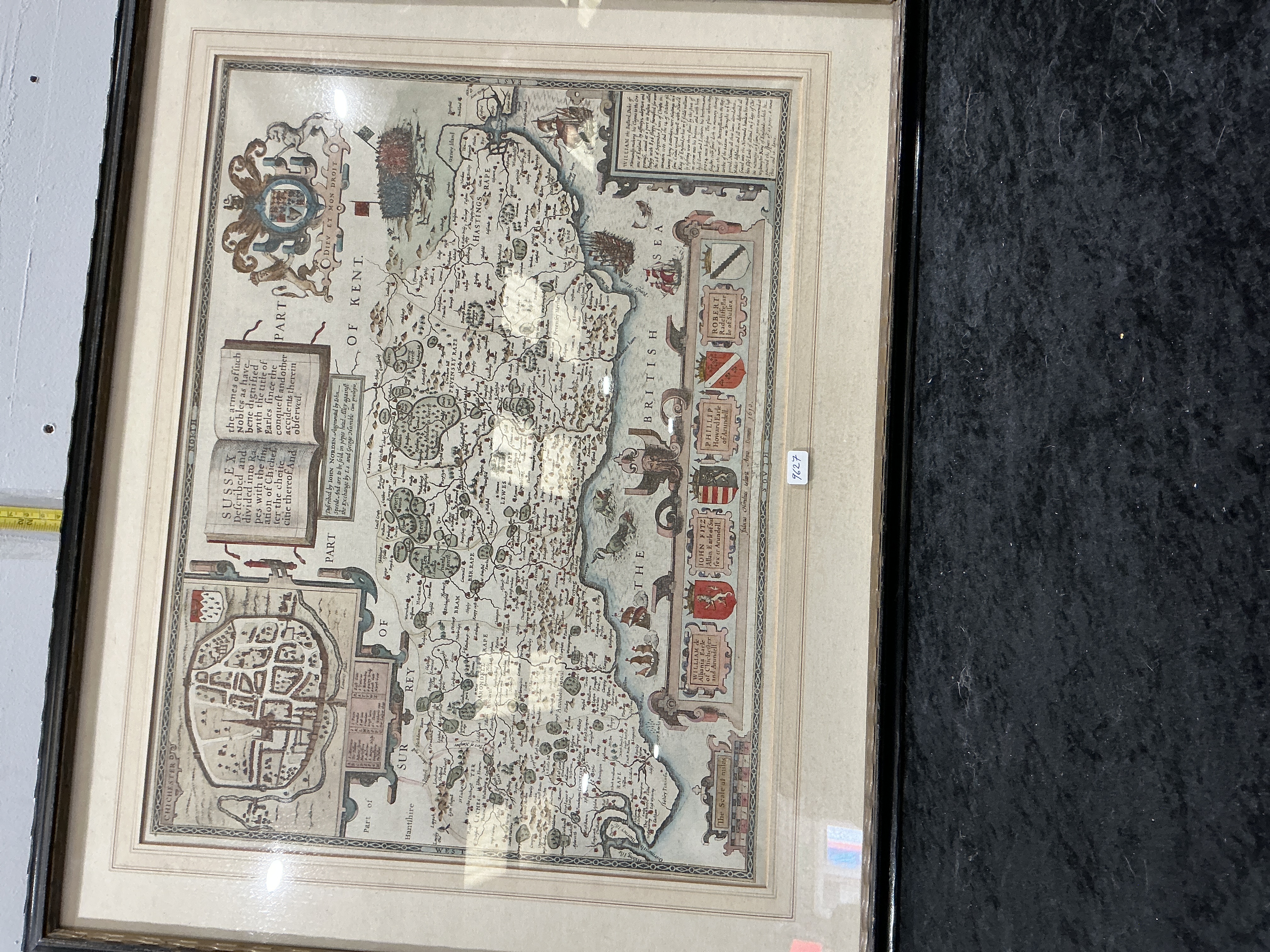
A seventeenth-century hand-coloured engraved map of Sussex by John Speed
Description
A hand-coloured copperplate engraved map of the county of Sussex, described by John Norden and augmented by John Speed (I.S.). The map was engraved by Jodocus Hondius and is dated 1610 within the plate. This map was originally published for Speed’s atlas, The Theatre of the Empire of Great Britaine. The cartography depicts the county divided into its six traditional administrative rapes: Chichester, Arundel, Bramber, Lewes, Pevensey, and Hastings.
The composition includes a detailed inset town plan of Chichester in the lower-left corner, accompanied by a locational key and the city’s heraldic arms. The right-hand margin features a vertical column of ten armorial shields representing the Earls of Sussex, including William de Albeney, John Fitz-Alan, and Robert Radcliffe. The Royal Arms are positioned in the upper-left corner. The sea is decorated with maritime illustrations including period sailing ships, a sea monster, and a compass rose. A historical text panel provides details regarding William the Conqueror and his landing at Hastings.
The title cartouche reads: SUSSEX Described and divided into Rapes with the situation of Chichester the cheife citie thereof And… A secondary text box states: Described by JOHN NORDEN Augmented by I.S. and are to be sold in pops head alley against the Exchange by I.S. and George Humble cum Privilegio. Further inscriptions include: Jodocus Hondius caelavit Anno 1610 in the bottom right and Johan: Norden deliniavit. Johannes Speede excudit along the bottom edge. The map is housed in a modern black frame with a cream-coloured mount.
Framed Dimensions: 55cm x 65cm.
Share this lot: